
  |

 Dec 29 2008, 07:33 AM Dec 29 2008, 07:33 AM
Post
#1
|
|
 Spends WAY too much time at CBTL  Group: Admin Posts: 16,425 Joined: 8-December 06 From: Michigan City, IN Member No.: 2 |
http://thenewsdispatch.com/main.asp?Sectio...ArticleID=19927
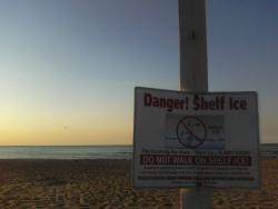
QUOTE Region braces for possible flooding MUNSTER, Ind. (AP) - For residents of northwest Indiana's Munster, the weekend weather forecast brought a sense of deja vu with warnings of possible flooding. "Just like last time," Rey Candelaria said Saturday morning as he stood on the Northcote Avenue bridge and watched the rising water below. The Little Calumet River was expected to crest at 13.1 feet around 6 a.m. Sunday, according to National Weather Service reports. Flood stage is 12 feet. The unwelcome forecast comes just a few months after September flooding forced Candelaria's family and hundreds of others from their homes. "If it comes up we'll be in trouble. Our residents can't take it again. They're just rebuilding their lives again," said Candelaria. He said he was tearing down and rebuilding his flood-damaged home. Northwest Indiana was under a flash flood warning until 9 p.m. Saturday as heavy rains and thunderstorms continued to soak the region. The National Weather Service said heavy rainfall could combine with snow melt to produce flooding. Moderate flooding was reported Saturday afternoon in Shelby in southern Lake County, where the Kankakee River was at 11.6 feet, 2 feet above flood stage. The river was expected to crest at 12.8 feet by Monday morning and major flooding was predicted. Meanwhile, Fort Wayne - where an ice storm last week left thousands of people without power, some for days - could have less flooding than anticipated earlier this week. The National Weather Service had no flood warnings for the area, though city storm drains were clogged with storm debris and some street flooding was expected. City crews were working to clear the drains and officials asked residents to help, said city spokeswoman Rebecca Karcher. Thunderstorms packing strong winds rumbled across much of the state Saturday, and the weather service issued a tornado warning early Saturday evening for several counties in western Indiana as radar indicated rotation in a storm passing through the region. Temperatures soared into the 60s and above, and the weather service said a record high of 73 was set in Evansville. The old record for the date was 67. |
   |

 
|
|
Dec 29 2008, 07:34 AM
Post
#2
|
|
|
Spends WAY too much time at CBTL Group: Admin Posts: 16,425 Joined: 8-December 06 From: Michigan City, IN Member No.: 2 |
http://thenewsdispatch.com/main.asp?Sectio...&TM=30949.6
QUOTE City issues flood advisory From Staff Reports MICHIGAN CITY - First an ice storm Friday, now possible flooding this weekend. Mayor Chuck Oberlie issued a weather advisory Friday morning cautioning citizens to be proactive in planning for forecasted weather this weekend. "A flood watch has been issued by the National Weather Service for Northern Indiana, which includes the Michigan City area," Oberlie said. John Jones, director of the City's Emergency Management Agency, spoke with meteorologists from the Syracuse office of the National Weather Service on Friday who reported a forecasted amount of rain fall of between 1 and 2 inches for the Michigan City area through today. Jones recommended making sure roof gutters are clear of leaves and debris and working properly. Downspout extensions are a good idea to divert water away from foundations, he said. People can also remove valuable items from basements as a precaution whenever flooding is a possibility. Mayor Oberlie issued the following precautions for citizens. "Please be cautious when traveling this weekend and watch for areas of fog and decreased visibility. City crews will be taking actions to mitigate effects of this weekend's weather," Oberlie said. "The Sanitary District will be cleaning drains around the city so that the water from the melting snow can be removed by the city's storm sewers." Oberlie also asked residents living near a storm sewer inlet to be vigilant in assisting by clearing drains of debris, snow and ice. "We anticipate that the early melting of snow will be helpful before the rain comes, in lessening the impact of any potential flooding hazards," Oberlie said. "The National Weather Service is more concerned with river flooding than they are with ground saturation flooding but getting tips out to citizens to help prevent any undue water problems are always in order." |
|
|
|
|
1 User(s) are reading this topic (1 Guests and 0 Anonymous Users)
0 Members:
| Lo-Fi Version | Time is now: 26th April 2024 - 12:15 AM |
Skin Designed By: neo at www.neonetweb.com
Invision Power Board
v2.1.7 © 2024 IPS, Inc.