
  |

 Jan 31 2011, 10:24 AM Jan 31 2011, 10:24 AM
Post
#61
|
|
|
Advanced Member  Group: Members Posts: 445 Joined: 24-August 07 From: Kissimmee, FL Member No.: 546 |
QUOTE(southsiderMMX @ Jan 30 2011, 10:12 PM)  According to Tom Skilling we are looking at 20 to 24 inches of snow  I live for weather like this. The snow blower has gas and the fridge is full of food! Bring it on!!!!!   Welcome to the Michigan City Area Schools, we are over budget, over paid, overwhelmed ... |
   |

 
|
|
Jan 31 2011, 07:55 PM
Post
#62
|
|
 Spends WAY too much time at CBTL Group: Admin Posts: 16,425 Joined: 8-December 06 From: Michigan City, IN Member No.: 2 |
Latest update has City in the 12 to 16" bracket now.
 |
|
|
|
|
Jan 31 2011, 07:56 PM
Post
#63
|
|
|
Advanced Member Group: Members Posts: 445 Joined: 24-August 07 From: Kissimmee, FL Member No.: 546 |
QUOTE(southsiderMMX @ Jan 31 2011, 07:55 PM) Latest update has City in the 12 to 16" bracket now. It will be 10-12 in the morning and 4-6 by the end of the day tomorrow. Welcome to the Michigan City Area Schools, we are over budget, over paid, overwhelmed ... |
|
|
|
|
Feb 1 2011, 08:44 AM
Post
#64
|
|
|
Spends WAY too much time at CBTL Group: Admin Posts: 16,425 Joined: 8-December 06 From: Michigan City, IN Member No.: 2 |
Today-Wednesday night...a sig winter storm will impact the region. Winds
will increase through morning into the afternoon with snow developing as massive height adjustment ensues per the advecting upper wave. Very intense forcing for upward... vertical motion noted by very strong q-vector convergence in the 500 mb-300 mb layer/potent tropopause positive pressure advection/and highly diffluent middle level height signature...with sig ageostrophic upglide expected. Thermal advections will support a warm nose into southern areas...with snow changing to sleet and freezing rain. A period of freezing rain is expected across the far southeast...where around a quarter inch of ice looks likely. Meanwhile snow will intensify as middle level lapse rates steepen/frontogenetical generated lift and upglide strengthens/and deep moisture advects into the area. Deformation banding is expected. Model investigation reveals negative saturated epv over much of the region at 700 mb...and cross sections indicate a very good setup for csi release through slantwise convection. Conditional instability will also be present with strongly convective snow squalls possible. Given mean track of the 850 mb/h7/h5 low and the proximity csi release in the dgz/and analog guidance from cips...the heaviest snow is expected somewhere across the northwest forecast area 50 miles either side of a kikk to ksbn line. Snowfall rates of 2 inches or more an hour will be possible...with 15 to 20 inches of snow expected. Thundersnow will be possible which would certainly increase local snow rates. Farther south...warm nosing with warm layer maximum T/S rising to 1-2c will support a mix of sleet...with lesser snow amounts. Farther south in Grant/Blackford/and Jay County...freezing rain is expected with around 0.25 inches of ice expected as snow/sleet mixes to freezing rain with warm layer temperatures approaching 4c. The other main concern will be surface winds. Given h95 geostrophic analysis/surface pressure falls/and heavy precipitation supporting momentum mix down...expecting sustained winds of 25 to 30 knots for several hours with gusts to 45 miles per hour coincident with the heaviest snow. This will support white out conditions/severe drifting with drifts of 4 to 8 feet expected/and definite Road closures...creating very dangerous conditions. Will issue a Blizzard Warning for most of the forecast area. This storm will definitely cripple the region as nearly all roads in the northwest forecast area will likely be closed at some point...even major highways given the magnitude of the storm. Snow and wind will gradually let up Wednesday morning...with a lingering lake effect band shifting into the west by Wednesday evening. Blowing and drifting is expected through Wednesday. Lake effect snow will wane heavily given backing/disrupting flow and falling inversion bases...but still be quite capable of dropping 1-2 inches over la port and Starke counties...lesser amounts east. |
|
|
|
|
Feb 1 2011, 08:52 AM
Post
#65
|
|
|
Spends WAY too much time at CBTL Group: Admin Posts: 16,425 Joined: 8-December 06 From: Michigan City, IN Member No.: 2 |
Issued by The National Weather Service
North Webster, IN 4:06 am CST, Tue., Feb. 1, 2011 ... BLIZZARD WARNING IN EFFECT FROM 1 PM EST /NOON CST/ THIS AFTERNOON TO 7 PM EST /6 PM CST/ WEDNESDAY... ... THIS REPLACES THE WINTER STORM WARNING... THE NATIONAL WEATHER SERVICE IN NORTHERN INDIANA HAS ISSUED A BLIZZARD WARNING... WHICH IS IN EFFECT FROM 1 PM EST /NOON CST/ THIS AFTERNOON TO 7 PM EST /6 PM CST/ WEDNESDAY. THIS REPLACES THE WINTER STORM WARNING. * TIMING... AFTER A SHORT LULL IN SNOW THIS MORNING... SNOW WILL EXPAND IN COVERAGE AND INTENSITY THIS AFTERNOON. SNOW WILL CONTINUE INTO WEDNESDAY AFTERNOON... ENDING WEDNESDAY EVENING. WINDS WILL INCREASE THIS AFTERNOON THROUGH TONIGHT... WITH THE STRONGEST WINDS EXPECTED OVERNIGHT. * MAIN IMPACT... SNOWFALL AMOUNTS OF 6 TO 18 INCHES ARE EXPECTED... WITH THE HIGHEST AMOUNTS IN NORTHWEST INDIANA AND SOUTHWEST LOWER MICHIGAN. SUSTAINED WINDS OF 20 TO 30 MPH WITH GUSTS UP TO 45 MPH WILL CREATE DANGEROUS CONDITIONS... WITH ZERO VISIBILITIES IN BLOWING SNOW AT TIMES AND SIGNIFICANT DRIFTING. SNOW DRIFTS OF 4 TO 8 FEET WILL BE POSSIBLE IN MANY OPEN AREAS. * OTHER IMPACTS... TRAVEL WILL BE HIGHLY IMPACTED WITH HEAVY SNOW AND BLOWING SNOW CREATING VERY DANGEROUS CONDITIONS. HIGHWAY CREWS WILL LIKELY HAVE A HARD TIME KEEPING UP WITH THE CONDITIONS... LEADING TO SEVERAL ROAD CLOSURES. UNNECESSARY TRAVEL SHOULD BE AVOIDED AT ALL COSTS. POWER OUTAGES WILL ALSO BE POSSIBLE DUE TO WET HEAVY SNOW AND GUSTY WINDS. PRECAUTIONARY/PREPAREDNESS ACTIONS... A BLIZZARD WARNING MEANS SEVERE WINTER WEATHER CONDITIONS ARE EXPECTED OR OCCURRING. FALLING AND BLOWING SNOW WITH STRONG WINDS AND POOR VISIBILITIES ARE LIKELY. THIS WILL LEAD TO WHITEOUT CONDITIONS... MAKING TRAVEL EXTREMELY DANGEROUS. DO NOT TRAVEL. IF YOU MUST TRAVEL... HAVE A WINTER SURVIVAL KIT WITH YOU. IF YOU GET STRANDED... STAY WITH YOUR VEHICLE. && More Information ... POWERFUL WINTER STORM TO AFFECT THE REGION... .A STRONG LOW PRESSURE SYSTEM WILL MOVE INTO THE OHIO VALLEY TONIGHT... SUPPORTING HEAVY SNOW AND MIXED PRECIPITATION INTO THE AREA. AFTER A LULL IN ACTIVITY THIS MORNING... HEAVY SNOW WITH SIGNIFICANT BLOWING AND DRIFTING IS LIKELY BY LATER THIS AFTERNOON OVER MUCH OF THE AREA... POSSIBLY MIXING WITH SLEET AND FREEZING RAIN SOUTH OF US 24. VERY HEAVY SNOW WILL CONTINUE TONIGHT INTO WEDNESDAY MORNING... ENDING BY WEDNESDAY EVENING. SNOWFALL RATES OF 1 TO 2 INCHES PER HOUR ARE EXPECTED TONIGHT... WITH ISOLATED SNOW PRODUCING THUNDERSTORMS BEING POSSIBLE. SNOW WILL MIX WITH OR CHANGE TO SLEET OR FREEZING RAIN SOUTH OF ROUTE 24... WITH SIGNIFICANT ICING POSSIBLE. ICE ACCUMULATIONS OF AROUND ONE QUARTER INCH ARE POSSIBLE... WITH THE HIGHEST ICING POTENTIAL NEAR AND SOUTH OF A LINE FROM MARION INDIANA TO OTTAWA OHIO. SNOWFALL AMOUNTS OF UP TO 18 INCHES WILL BE POSSIBLE WITH THIS SYSTEM... WITH LOCALLY HIGHER AMOUNTS OF OVER 20 INCHES NOT OUT OF THE REALM OF POSSIBILITY. THESE HIGHER SNOWFALL AMOUNTS WILL BE ACROSS FAR NORTHERN INDIANA AND SOUTHWEST LOWER MICHIGAN. SUSTAINED WINDS OF 20 TO 30 MPH WITH GUSTS UP TO 45 MPH... WILL CREATE WIDESPREAD BLOWING AND DRIFTING SNOW... WITH DRIFTS POTENTIALLY REACHING SEVERAL FEET IN SOME LOCATIONS. BLIZZARD TO NEAR BLIZZARD CONDITIONS ARE EXPECTED IN MANY AREAS... ESPECIALLY ACROSS FAR NORTHERN INDIANA... SOUTHWEST LOWER MICHIGAN AND FAR NORTHWEST OHIO. VISIBILITIES WILL BE DOWN TO ZERO AT TIMES TONIGHT AND WEDNESDAY MORNING. TRAVEL WILL LIKELY BE DIFFICULT TO IMPOSSIBLE IN MANY AREAS... WITH ROAD CLOSURES LIKELY. |
|
|
|
|
Feb 1 2011, 08:57 AM
Post
#66
|
|
|
Spends WAY too much time at CBTL Group: Admin Posts: 16,425 Joined: 8-December 06 From: Michigan City, IN Member No.: 2 |
http://weblogs.wgntv.com/chicago-weather/t...-the-bigge.html
By wgnweather on January 26, 2010 9:56 PM | Permalink Dear Tom, All the recent heavy lake-effect snow in northern Indiana reminded me of a huge storm that paralyzed Michigan City, Ind., in the 1950s or '60s. Can you provide details? --Larry Robinson Dear Larry, On Feb. 15 and 16, 1958, one of the biggest Lake Michigan snow events on record buried Michigan City with more than 40 inches of snow during a period of about 36 hours. The strong winds blowing arctic air down the full length of the lake piled the snow into huge drifts, some as high as 15 feet. The snow was so deep that bulldozers were needed to help the town dig out. The area of the exceptionally heavy snow was small and neighboring communities thought the snowstorm was a hoax because skies as close as Gary were clear. Nearby LaPorte received 5 feet of snow in February 1958, much of it falling during that storm. |
|
|
|
|
Feb 1 2011, 09:07 AM
Post
#67
|
|
|
Spends WAY too much time at CBTL Group: Admin Posts: 16,425 Joined: 8-December 06 From: Michigan City, IN Member No.: 2 |
QUOTE(southsiderMMX @ Feb 1 2011, 08:57 AM) http://weblogs.wgntv.com/chicago-weather/t...-the-bigge.html By wgnweather on January 26, 2010 9:56 PM | Permalink Dear Tom, All the recent heavy lake-effect snow in northern Indiana reminded me of a huge storm that paralyzed Michigan City, Ind., in the 1950s or '60s. Can you provide details? --Larry Robinson Dear Larry, On Feb. 15 and 16, 1958, one of the biggest Lake Michigan snow events on record buried Michigan City with more than 40 inches of snow during a period of about 36 hours. The strong winds blowing arctic air down the full length of the lake piled the snow into huge drifts, some as high as 15 feet. The snow was so deep that bulldozers were needed to help the town dig out. The area of the exceptionally heavy snow was small and neighboring communities thought the snowstorm was a hoax because skies as close as Gary were clear. Nearby LaPorte received 5 feet of snow in February 1958, much of it falling during that storm. And very cool footage on YouTube from the cleanup. |
|
|
|
|
Feb 1 2011, 09:13 AM
Post
#68
|
|
|
Spends WAY too much time at CBTL Group: Admin Posts: 5,171 Joined: 11-December 06 From: Indiana Member No.: 10 |
Went to WalNart after work to pick up some staples--just in case--and the food was almost all gone. The employees were stocking the shelves as fast as they could, but they didn't have much left to put out. The grocery dept mgr said that they probably wouldn't have anything left at all after today. The check-out girl told me that two men got in a fist fight over a loaf of bread and the police were called. And several people said yesterday was worse than black friday.
Is the moon full? Be who you are and say what you feel because those who mind don't matter and those who matter don't mind~Dr. Suess
|
|
|
|
|
Feb 1 2011, 09:20 AM
Post
#69
|
|
|
Spends WAY too much time at CBTL Group: Admin Posts: 5,171 Joined: 11-December 06 From: Indiana Member No.: 10 |
Hey LoveCity--My Sister is moving back from WY this week. Think she's bringing this with her?
Be who you are and say what you feel because those who mind don't matter and those who matter don't mind~Dr. Suess
|
|
|
|
|
Feb 1 2011, 09:28 AM
Post
#70
|
|
|
Advanced Member Group: Members Posts: 445 Joined: 24-August 07 From: Kissimmee, FL Member No.: 546 |
 LaPorte Community Schools may release early... LaPorte Community Schools may release early...Welcome to the Michigan City Area Schools, we are over budget, over paid, overwhelmed ... |
|
|
|
|
Feb 1 2011, 09:48 AM
Post
#71
|
|
|
Spends WAY too much time at CBTL Group: Admin Posts: 16,425 Joined: 8-December 06 From: Michigan City, IN Member No.: 2 |
QUOTE(southsiderMMX @ Feb 1 2011, 09:07 AM) And very cool footage on YouTube from the cleanup. http://www.youtube.com/watch?v=cOuWpw_6N9U QUOTE(Ang @ Feb 1 2011, 09:13 AM) Went to WalNart after work to pick up some staples--just in case--and the food was almost all gone. The employees were stocking the shelves as fast as they could, but they didn't have much left to put out. The grocery dept mgr said that they probably wouldn't have anything left at all after today. The check-out girl told me that two men got in a fist fight over a loaf of bread and the police were called. And several people said yesterday was worse than black friday. Is the moon full? That's why I went early. I guess after work, there wasn't even a cart to be had in the store. |
|
|
|
|
Feb 1 2011, 09:57 AM
Post
#72
|
|
|
Advanced Member Group: Members Posts: 445 Joined: 24-August 07 From: Kissimmee, FL Member No.: 546 |
QUOTE(eric.hanke @ Feb 1 2011, 09:28 AM) LaPorte Community Schools may release early...Tuesday, February 01, 2011 LP Schools WILL release early today. LaPorte High School and both middle schools will release at 1:00 p.m. All elementary schools will release at 1:30 p.m. Welcome to the Michigan City Area Schools, we are over budget, over paid, overwhelmed ... |
|
|
|
|
Feb 1 2011, 12:04 PM
Post
#73
|
|
|
Spends WAY too much time at CBTL Group: Admin Posts: 16,425 Joined: 8-December 06 From: Michigan City, IN Member No.: 2 |
As of now the City Council meeting is still on for tonight. If that changes, I will post it.
|
|
|
|
|
Feb 1 2011, 12:53 PM
Post
#74
|
|
|
Spends WAY too much time at CBTL Group: Admin Posts: 16,425 Joined: 8-December 06 From: Michigan City, IN Member No.: 2 |
http://newsfeed.time.com/2011/02/01/the-sn...hicago-tonight/
QUOTE The Snowpocalypse Tsunami? Blizzard Could Send 18-Foot Waves Into Downtown Chicago Tonight By: Nick Carbone (41 mins ago) Topics: blizzard, Chicago, Epic, lake shore drive, life threatening, nation, Snow, tsunami, us, waves Meteorologists fear a blizzard will send 18-foot waves over the shores of Lake Michigan. Tonight's massive impending snowfall is no surprise - it's been forecast for the past week. But as the storm swirls closer to Chicago, the headlines just keep getting worse. The crushing clipper is expected to sweep through the Chicago area beginning 3 p.m. Tuesday and will linger until Wednesday afternoon. It's been called a blizzard of “epic” proportions, a “potentially life-threatening” system featuring thundersnow, multiple feet of accumulation, and gale-force winds. And now, tack on the potential for waves cresting over the shores of Lake Michigan, threatening homes and roads. (More on TIME.com: See photos of snowstorms hitting the east coast – again.) The National Weather Service has issued a “Lakeshore Flood Warning”, stating that “strong winds will likely result in waves building to 14 to 18 feet,” which could cause flooding on Chicago's streets. One of the city's main downtown arteries, Lake Shore Drive, runs – you guessed it – right along the lakeshore and could face a washout of water and ice. Add that to 60 mph winds, lightning, and a predicted accumulation of 2 to 3 inches per hour, according to meteorologist Richard Castro, and it's no surprise, then, that the NWS is deeming the storm “dangerous, multifaceted and life-threatening.” Illinois Governor Pat Quinn issued a statewide disaster declaration Monday so cities and towns could prepare for the impending mess of at least a foot of snow across the Chicagoland area, with as much as 18 inches expected along the lakefront. (More on TIME.com: See video of Obama's Chicago roots.) Chicagoans are accustomed to disappointment in the weather department, with panic over dangerous storms often giving way to tame systems. It could be that fabled lake effect or just overhype – but the Chicago Tribune casts off the naysayers this time, saying the impending blizzard (yes, it's already being called a blizzard) “appears anything but gentle.” And New Yorkers, who've faced nearly 5 feet of snow this winter, can commiserate – until the same system rolls eastward for a messy Wednesday morning in the Big Apple. (via Chicago Sun-Times) Read more: http://newsfeed.time.com/2011/02/01/the-sn.../#ixzz1CjcbSFlt |
|
|
|
|
Feb 1 2011, 01:03 PM
Post
#75
|
|
|
Spends WAY too much time at CBTL Group: Admin Posts: 5,171 Joined: 11-December 06 From: Indiana Member No.: 10 |
Thundersnow is very eerie. We had that in WY while I lived out there.
It is very bizarre to have the snow falling in blankets with thunder and lightening. Makes the hair on your arms stand up. Be who you are and say what you feel because those who mind don't matter and those who matter don't mind~Dr. Suess
|
|
|
|
|
Feb 2 2011, 01:05 PM
Post
#76
|
|
|
Spends WAY too much time at CBTL Group: Admin Posts: 16,425 Joined: 8-December 06 From: Michigan City, IN Member No.: 2 |
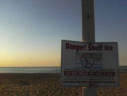
Some good pictures from around town today.
http://www.facebook.com/pages/City-By-the-...;id=44763113874 |
|
|
|
|
Feb 2 2011, 05:02 PM
Post
#77
|
|
|
Really Comfortable Group: Members Posts: 627 Joined: 9-February 07 Member No.: 41 |
QUOTE(Ang @ Feb 1 2011, 09:20 AM) Hey LoveCity--My Sister is moving back from WY this week. Think she's bringing this with her? You know I do! From what I understand the National Guard will be escorting you and your sister to the Wisconsin border........... once the snow stops. |
|
|
|
|
Feb 4 2011, 09:27 AM
Post
#78
|
|
|
Spends WAY too much time at CBTL Group: Admin Posts: 16,425 Joined: 8-December 06 From: Michigan City, IN Member No.: 2 |
|
|
|
|
|
Apr 10 2011, 03:31 PM
Post
#79
|
|
|
Spends WAY too much time at CBTL Group: Admin Posts: 16,425 Joined: 8-December 06 From: Michigan City, IN Member No.: 2 |
FYI
QUOTE Tom Skilling Storm-suprressing "cap" still in place across much of northern Illinois (the stipled blue area). That's continuing to inhibit upward motion of air and, therefore, t-storm development. You can see that in this latest analysis from the Storm Prediction Center. But also note CAPEs (Convective Energy values) of 2000 j/kg--very high. This is all on track with model projections. Lid to come off and t-storms to fire over the next 1-3 hrs. |
|
|
|
|
Apr 15 2011, 01:12 PM
Post
#80
|
|
|
Spends WAY too much time at CBTL Group: Admin Posts: 16,425 Joined: 8-December 06 From: Michigan City, IN Member No.: 2 |
http://www.wdtn.com/dpp/weather/wdt_alert/...visory_39012262
[quote]Wind Advisory Issued At: Friday, 15 Apr 2011, 10:52 AM EDT Expires At: Friday, 15 Apr 2011, 10:00 PM EDT URGENT - WEATHER MESSAGE NATIONAL WEATHER SERVICE NORTHERN INDIANA 1052 AM EDT FRI APR 15 2011 ...VERY WINDY CONDITIONS ACROSS THE AREA THROUGH THIS EVENING... .AN AREA OF DEEPENING LOW PRESSURE ACROSS EASTERN KANSAS WILL TRACK INTO WEST CENTRAL ILLINOIS LATE THIS EVENING. EAST WINDS OF 25 TO 35 MPH CAN BE EXPECTED...WITH A FEW GUSTS TO 45 MPH POSSIBLE. WINDS ARE EXPECTED TO DIMINISH BELOW ADVISORY CRITERIA BY MID TO LATE EVENING. LA PORTE-ST. JOSEPH IN-ELKHART-LAGRANGE-STEUBEN-NOBLE-DE KALB- STARKE-PULASKI-MARSHALL-FULTON IN-KOSCIUSKO-WHITLEY-ALLEN IN- WHITE-CASS IN-MIAMI-WABASH-HUNTINGTON-WELLS-ADAMS-GRANT-BLACKFORD- JAY-BERRIEN-CASS MI-ST. JOSEPH MI-BRANCH-HILLSDALE-WILLIAMS- FULTON OH-DEFIANCE-HENRY-PAULDING-PUTNAM-VAN WERT-ALLEN OH- INCLUDING THE CITIES OF...MICHIGAN CITY...LA PORTE...SOUTH BEND... MISHAWAKA...NEW CARLISLE...WALKERTON...ELKHART...GOSHEN... NAPPANEE...LAGRANGE...TOPEKA...SHIPSHEWANA...ANGOLA...FREMONT... KENDALLVILLE...LIGONIER...ALBION...AUBURN...GARRETT...KNOX... NORTH JUDSON...BASS LAKE...WINAMAC...FRANCESVILLE...MEDARYVILLE... PLYMOUTH...BREMEN...CULVER...ROCHESTER...AKRON...WARSAW... WINONA LAKE...SYRACUSE...MENTONE...COLUMBIA CITY...TRI-LAKES... SOUTH WHITLEY...FORT WAYNE...NEW HAVEN...MONTICELLO...BROOKSTON... MONON...LOGANSPORT...ROYAL CENTER...PERU...GRISSOM AFB...MEXICO... WABASH...NORTH MANCHESTER...HUNTINGTON...ROANOKE...BLUFFTON... OSSIAN...DECATUR...BERNE...MARION...GAS CITY...UPLAND... HARTFORD CITY...MONTPELIER...PORTLAND...DUNKIRK...NILES... BENTON HARBOR...ST. JOSEPH...BUCHANAN...DOWAGIAC...CASSOPOLIS... MARCELLUS...STURGIS...THREE RIVERS...WHITE PIGEON...MENDON... COLDWATER...BRONSON...HILLSDALE...LITCHFIELD...JONESVILLE... BRYAN...WAUSEON...ARCHBOLD...FAYETTE...SWANTON...DEFIANCE... SHERWOOD...HICKSVILLE...NAPOLEON...DESHLER...LIBERTY CENTER... PAULDING...ANTWERP...MELROSE...OTTAWA...PANDORA...KALIDA... FORT JENNINGS...VAN WERT...DELPHOS...OHIO CITY...LIMA... SPENCERVILLE 1052 AM EDT FRI APR 15 2011 /952 AM CDT FRI APR 15 2011/ ...WIND ADVISORY IN EFFECT UNTIL 10 PM EDT /9 PM CDT/ THIS EVENING... THE NATIONAL WEATHER SERVICE IN NORTHERN INDIANA HAS ISSUED A WIND ADVISORY...WHICH IS IN EFFECT UNTIL 10 PM EDT THIS EVENING. * TIMING...EAST WINDS OF 20 TO 30 MPH WILL INCREASE TO 25 TO 35 MPH THIS AFTERNOON WITH SOME GUSTS TO 45 MPH POSSIBLE. WINDS WILL BEGIN TO SUBSIDE BY THE MID TO LATE EVENING HOURS. * WINDS...EAST WINDS 25 TO 35 MPH WITH SOME GUSTS TO 45 MPH. * IMPACTS...HIGH WINDS WILL MAKE TRAVEL ON NORTH TO SOUTH ORIENTED ROADS DIFFICULT AT TIMES...ESPECIALLY FOR HIGH PROFILE VEHICLES. LOOSE OBJECTS SUCH AS LAWN FURNITURE AND TRASH CANS WILL ALSO BE BLOWN AROUND. PRECAUTIONARY/PREPAREDNESS ACTIONS... A WIND ADVISORY MEANS THAT WINDS OF 35 MPH ARE EXPECTED. WINDS THIS STRONG CAN MAKE DRIVING DIFFICULT...ESPECIALLY FOR HIGH PROFILE VEHICLES. USE EXTRA CAUTION. |
|
|
|
|
1 User(s) are reading this topic (1 Guests and 0 Anonymous Users)
0 Members:
| Lo-Fi Version | Time is now: 28th April 2024 - 07:42 PM |
Skin Designed By: neo at www.neonetweb.com
Invision Power Board
v2.1.7 © 2024 IPS, Inc.