
  |

 Jun 20 2014, 12:10 PM Jun 20 2014, 12:10 PM
Post
#1
|
|
 Spends WAY too much time at CBTL  Group: Admin Posts: 16,423 Joined: 8-December 06 From: Michigan City, IN Member No.: 2 |
More at link
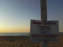
http://articles.chicagotribune.com/2014-06...al-park-service QUOTE Half-century later, 'Kennedy Compromise' yields Lake Michigan erosion Costly, timely plan to fix the issue causes controversy between agencies June 13, 2014|By Ted Gregory, Tribune reporter The flow of sand on the southernmost tip of Lake Michigan is out of balance, creating serious erosion in some places and too much sand in others, experts say. After decades of treating the problem at Indiana Dunes National Lakeshore in a more or less piecemeal fashion, the National Park Service is composing what it says is a comprehensive strategy to resolve the problem. Months before a formal plan is released, however, the 20-year, nearly $41 million effort is tangled in controversy and faces a daunting path before work starts, if it ever does. "I can pretty much guarantee that whatever solution they come up with will be something complicated, something costly and something that will require a great deal of cooperation between all the people involved," said Nicole Barker, executive director of Save the Dunes, which was established in 1952, 14 years before the area was declared a national park. Today, close to 2 million people a year visit the 15,000-acre ecological gem wedged in an industrial landscape, according to the National Park Service. Forty percent come from Illinois. And peak season starts now. The trouble with sand flow along the 15 miles of national park shoreline stems primarily from three man-made structures: the Michigan City Harbor, completed in the early 1900s; Port of Indiana, built in the late 1960s; and Gary-U.S. Steel Harbor, also constructed early in the last century. Another factor is what the National Park Service calls "engineered peninsulas" created primarily for industrial expansion and amounting to more than 4,000 acres of land extending into the lake. The effect is a disruption of the littoral drift, which is the flow of sediment generally from east to west along the shoreline. On one side of the structures, sand builds up. On the other, waves gouge the beaches. Before industrial and residential development, that shoreline included swamps, marshes, dunes, oak savannas and prairies — all of which allowed the sand flow to achieve equilibrium. That started changing perhaps as early as 1834, when construction of the Michigan City Harbor began, and continues today. It's unclear precisely how much sand and sediment waves drive out of eroding areas. But the National Park Service calculates that the beach at Mount Baldy, on the far eastern end of the park, loses about 4.5 feet per year. The 126-foot-high dune has been closed since July 2013, when a 6-year-old boy was swallowed by a hole and buried under 11 feet of sediment for three hours. He survived. The highest accumulation, or accretion, was found at the Port of Indiana, in the western section of the park, where sediment accumulates at a rate of about 7.6 feet per year, the National Park Service calculates. "Every mile you go along the lakefront," Barker said, "you experience something different in terms of shoreline issues." `The Kennedy Compromise' The person many point to as being responsible for complications swirling around Indiana Dunes National Lakeshore is a president who generally basks in a flattering glow of history: John F. Kennedy. By the time he was elected president in 1960, Indiana's southern shore of Lake Michigan had for decades been recognized as a rare natural environment, in part through the efforts of University of Chicago botanist Henry Cowles. The scientist, who died in 1939, brought international attention to an intricate ecosystem that today ranks third-highest in plant diversity among all national parks and is known as the place where the several ecological plant zones converge. Residents first proposed a national park in 1915, but others in the region pushed for industrial uses on the lakefront, including an international port. In 1963, Kennedy offered "The Kennedy Compromise," which allowed both. Three years later, Sen. Paul Douglas of Illinois ushered through legislation that created the 8,300-acre Indiana Dunes National Lakeshore. Four expansions nearly doubled the park's size over the years, but industrial, commercial and residential pockets also exist in or near the national lakeshore, as does a 2,200-acre state park with 3 miles of lakeshore. The entire shoreline between the west and east ends of the national park runs 21 miles, but only 15 are in the Indiana Dunes National Lakeshore. Beyond creating environmental complications, the compromise also has created tensions over land use, but Barker and National Park Service spokesman Bruce Rowe said the compromise was a practical solution to a challenging problem. Geof Benson is Town Council president of Beverly Shores, which is surrounded by the national park. He said resentment became particularly intense when the Park Service began buying homes in the 1970s. He added that many of the industries that moved to the lakefront could have received the same benefits if they'd gone inland 10 miles and "connected a pipe" to the lake. |
   |

 
|
|
Sep 12 2014, 11:48 AM
Post
#2
|
|
|
Spends WAY too much time at CBTL Group: Admin Posts: 16,423 Joined: 8-December 06 From: Michigan City, IN Member No.: 2 |
http://www.chestertontribune.com/Environme...on_national.htm
QUOTE Info meeting Monday on National Park Service preferred plan to fight beach erosion Back To Front Page The National Park Service (NPS) has released the final Environmental Impact Statement for the “Shoreline Restoration and Management Plan” (EIS) for Indiana Dunes National Lakeshore. Funded through the Great Lakes Restoration Initiative--in collaboration with the U.S. Environmental Protection Agency and the U.S. Army Corps of Engineers--the plan recommends methods to remedy erosion and damage to the dunes and beaches of Indiana Dunes National Lakeshore. The National Lakeshore will host an informational meeting at 6 p.m. Monday, Sept. 15, at the Dorothy Buell Memorial Visitor Center, at which the Final EIS will be presented and questions answered. No comments, however, will be taken on the document. The National Lakeshore includes most of the beaches along Indiana’s shoreline from Trail Creek in Michigan City to U.S. Steel in Gary. As described in the final EIS, the shoreline in this area suffers from erosion which threatens national park resources, recreation opportunities, homes, industry, and businesses. “The final EIS has been prepared to provide scientifically-based alternatives for the restoration of natural sediment movement along the southern shore of Lake Michigan within Indiana Dunes National Lakeshore,” NPS said. For the purpose of this plan the shoreline was divided into four sections (referred to as reaches) based upon sediment erosion and accretion. The final EIS evaluated seven possible alternatives for reaches 1 and 2, extending from Crescent Dune to Willow Lane, and four alternatives were evaluated for reaches 3 and 4, extending from Willow Lane to the City of Gary’s US Steel breakwater. “It was determined through the draft EIS process that all alternatives met park purposes and objectives, and were consistent with the legislative intent of Indiana Dunes National Lakeshore, applicable NPS laws, policies, and regulations,” NPS said. “New alternatives were developed due to substantive public comment on the draft EIS. The new preferred alternative for reaches 1 and 2 is a hybrid that incorporates aspects of multiple draft alternatives. This alternative, Alternative F, incorporates aspects of alternatives C-1, B-1, and E, providing for beach nourishment that incorporates natural small stones mixed with sand at the shoreline.” Meanwhile, all draft alternatives for reaches 3 and 4 provided for beach nourishment differentiated chiefly by frequency (annual or every five years), NPS said. “Due to substantive public comment on nourishment frequency, the final alternative selected for reaches 3 and 4 was changed from Alternative C-5 (five year frequency) to Alternative C-1 (annual frequency).” Beginning on Friday, a copy of the final EIS will be available in three different formats. It can be found on line at http://parkplanning.nps.gov/indu or else a CD of the document or one of a limited number of hard copies can be requested by contacting Florida Harris at (219) 395-8585, ext. 1772. |
|
|
|
|
Sep 17 2014, 03:50 PM
Post
#3
|
|
|
Spends WAY too much time at CBTL Group: Admin Posts: 16,423 Joined: 8-December 06 From: Michigan City, IN Member No.: 2 |
http://www.chestertontribune.com/Environme...tens_abando.htm
QUOTE Public speaks; NPS listens, abandons cobble berm plan for beaches Back To Front Page By KEVIN NEVERS The National Park Service (NPS) has abandoned a plan to construct a “cobble berm” under 10 feet of water off Crescent Dune east of Mt. Baldy, after NPS received “substantive comment” from the public objecting to the plan. The cobble berm had been the preferred alternative of a draft “Shoreline Restoration and Management Plan” for Indiana Dunes National Lakeshore, aimed at combating beach erosion, caused by man-made structures--like the Michigan City Harbor--which are interfering with the normal flow of sand to the west. As NPS announced last week, however, the cobble berm has been replaced with a new alternative: a hybrid of several other alternatives providing for beach nourishment which incorporates natural small stones mixed with sand at the shoreline. As Dr. Charles Morris, a biologist at the National Lakeshore, told the Chesterton Tribune at an information session Monday evening at the Dorothy Buell Memorial Visitor Center, the cobble berm would never have been anything but a temporary installation, whose whole point was to disintegrate over time into the substrate of the shoreline, covering and stabilizing the aggregate material of the lakebed. “It was designed to fail,” Morris said. The public, however, made its feelings about a cobble berm pretty clear, “such that we felt a change in our position was appropriate,” Morris noted. Morris did say that cobble berm was one of a number of initial shortlisted alternatives, all of which NPS determined would meet the objectives of restoring the National Lakeshore shoreline. “But there was a miscue in how we presented it,” he said. The draft drawing represented it “as a structure” and “that set people in the wrong direction from the start.” And the word itself--“cobble”--gave folks an incorrect impression of the size and durability of the materials which would have comprised the berm. Among the public’s objections--which accounted for “the largest numbers” of the 99 comments submitted to NPS--were the following: * The draft EIS “does not fully address the effects of the cobble berm on existing lake-bottom conditions.” * The draft EIS “does not fully address the ecological consequences of placing large quantities of cobble on the lakebed, nor does it provide sufficient evidence that these materials are a natural component of the system.” * Drawings in the draft EIS “do not accurately present the placement of the cobble berm nor does it provide adequate information on how the berm will be marked to minimize the risk to recreational boating craft.” Replacing the proposed cobble berm was the right and natural thing to do, given the public’s feelings about it, Morris said. And the new alternative--a nourishment plan using small stones mixed with sand--actually duplicates conditions at Dunbar Beach in Beverly Shores, downdrift from Crescent Dunes. “We sampled the conditions at Dunbar Beach and used that material as our standard,” Morris said. “We don’t intend to create a situation on the shoreline that doesn’t already exist.” NPS heeded public comment in one other way, Morris noted: by increasing the proposed frequency of beach nourishment in reaches 3 and 4--which includes the Portage Lakefront and Riverwalk site and West Beach--to every year, instead of every five years. “The public preferred it be done annually,” he said. |
|
|
|
|
1 User(s) are reading this topic (1 Guests and 0 Anonymous Users)
0 Members:
| Lo-Fi Version | Time is now: 24th April 2024 - 02:27 PM |
Skin Designed By: neo at www.neonetweb.com
Invision Power Board
v2.1.7 © 2024 IPS, Inc.